
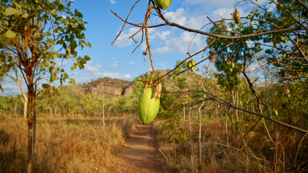
we didn’t know what to expect of kakadu and to be honest the drive there from darwin doesn’t really prepare you either. that road takes you through what seems pretty normal australian bush. the first hint at what’s to come is the mary river billabong.
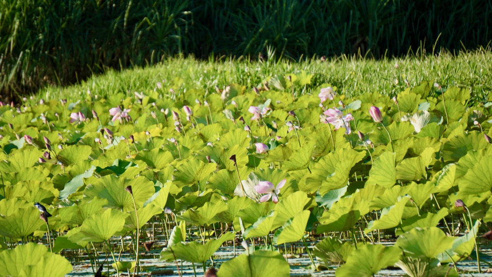
it’s pretty unusual in a couple of ways, and only one of them is the fact that the mary river doesn’t actually flow anywhere …. except into said billabong (which is an aussie name for a smallish lake).
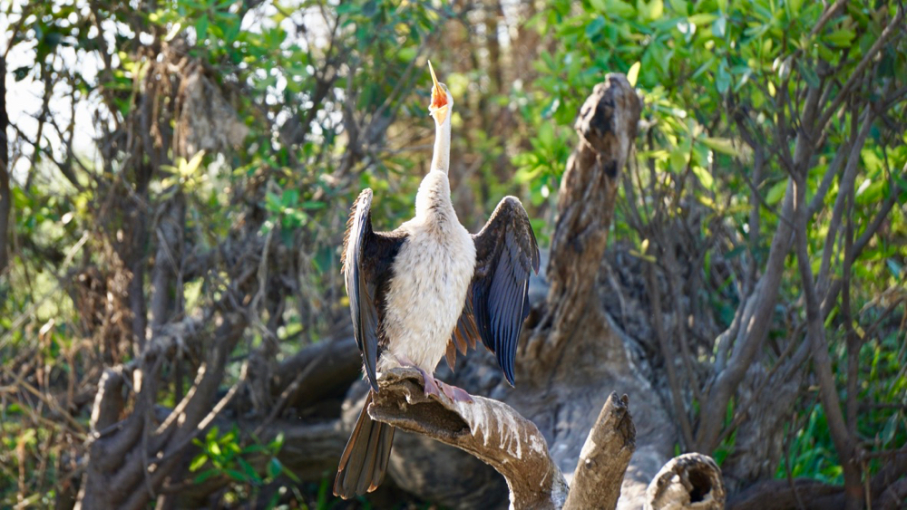
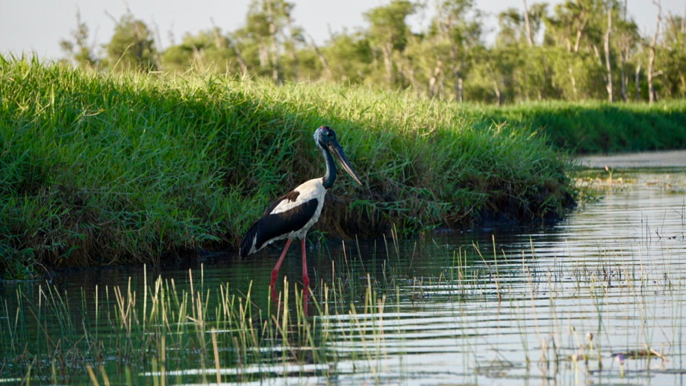
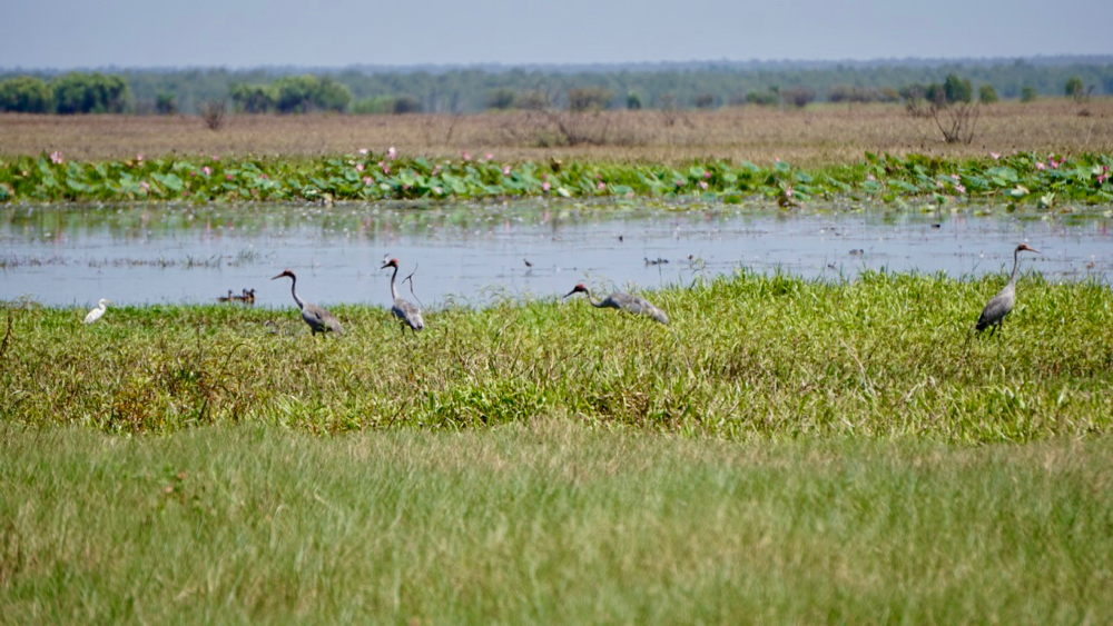
the billabong supports an amazing amount of wildlife, birdlife in particular. there are darters, ergrets, pelicans, sea eagles, the omnipresent whistling kites, brolgas and jabirus (more correctly named black necked storks).
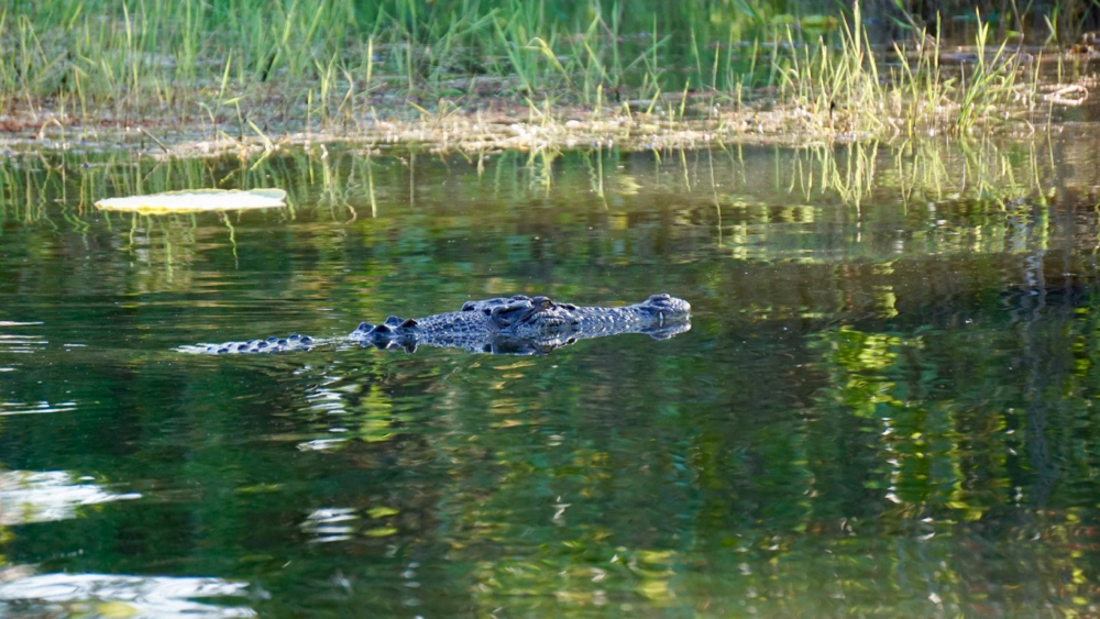
more ominous but much less visible the billabong is also home to a number of freshies and salties. it’s important to remember, and many signs across the northern territory scream this message, that salties can live in saltwater but they are just equally comfortable in freshwater. their only condition, if there was any, would be that they prefer their water murky.
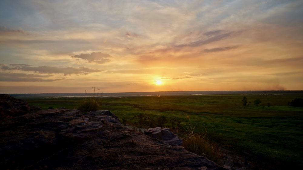
much of the area along the coast of northern australia is a floodplain: when the monsoon rains start to fall a lot of it will be under water. the strength of the ‘wet’ determines how much and how deep, but big parts of what looks like green pastures (or increasingly yellow pastures later in the ‘dry’) will be sometimes several meters under water when the rain comes.
as the water slowly drains into the sea after the wet the resulting billabongs get smaller and smaller; in the end only the bigger ones remain all year round.
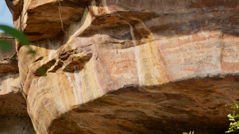
the stone country is where many animal and, in the past, people seek shelter from the floods of the wet. massive sandstone cliffs, almost 2 billion years old, stand on the border of the floodplains. this was not always the case: 20,000 years ago, during the last ice age, a significant amount of water was bound up in the ice sheets covering large parts of the world. as a result the shoreline was 300 km further north and the ancient inhabitants of australia lived in a much drier place.
they used many of the same rock shelters their descendants did until just recently and left evidence of their lives. scientists believe they were – had to be – much more nomadic as food was harder to find. their drawings were much simpler, maybe not so much because they were less talented but because they only spent brief periods of time at a shelter before moving on. this is evident in the fact that fewer artefacts were found in these earlier layers when archeologists excavated these sites.
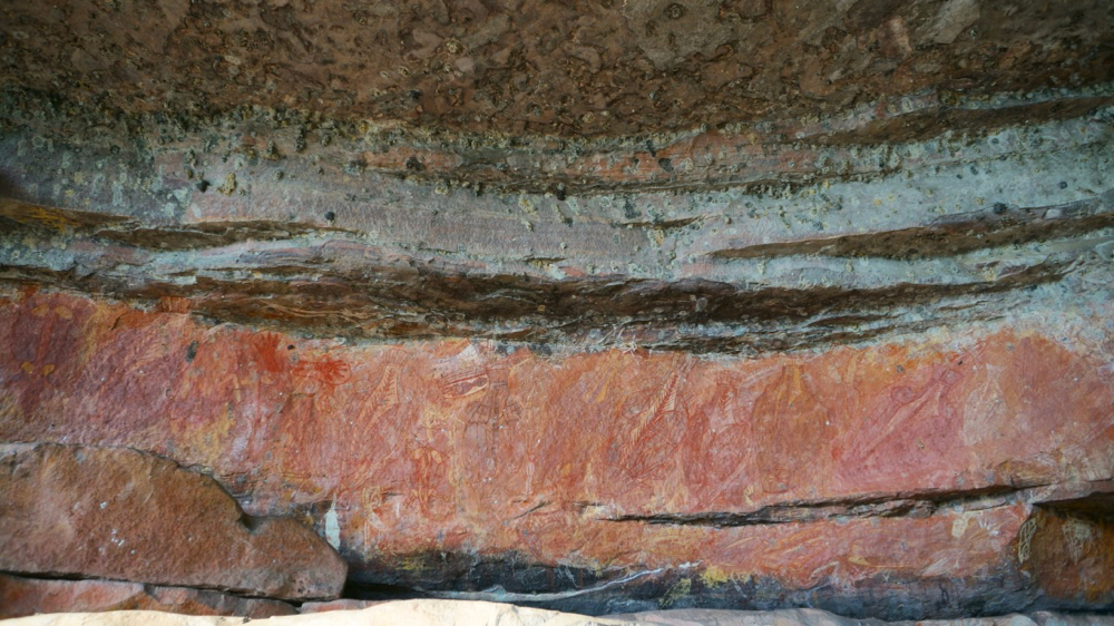
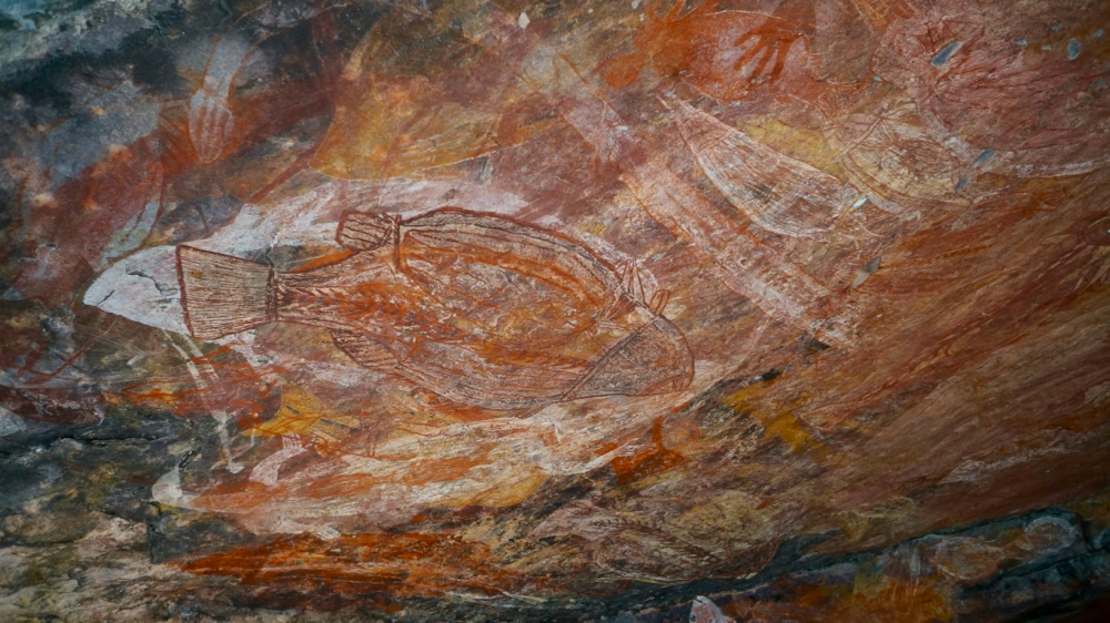
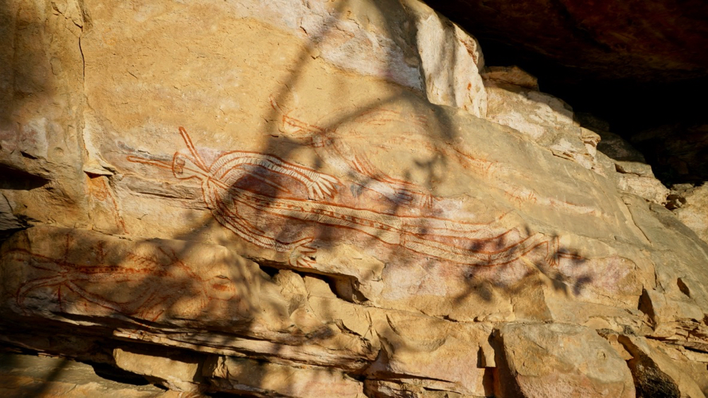
they left drawings of megafauna animals (not where we could see them but in arnhemland, which is less accessible to tourists) but also of the thylacine (tasmanian tiger, middle of the photo below) which died out on the mainland about 4000 years ago.
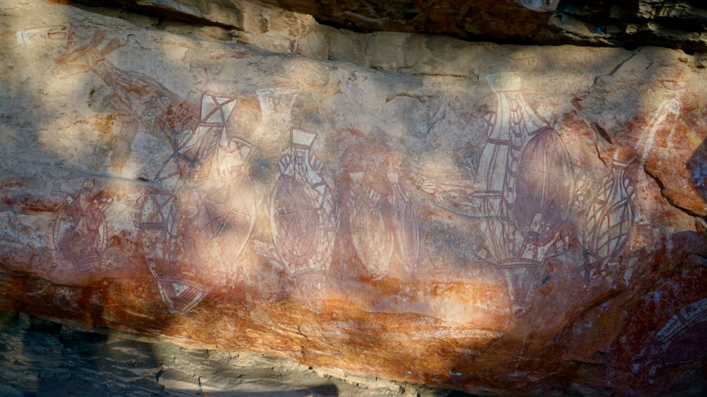
overall scientists found that there were fourteen layers of drawings on the wall of this particular shelter at ubirr. some date back many thousands of years, others were added as late as the 1960ies. i think that’s fair enough, who wouldn’t want to change the tapestry every thousand years or so.
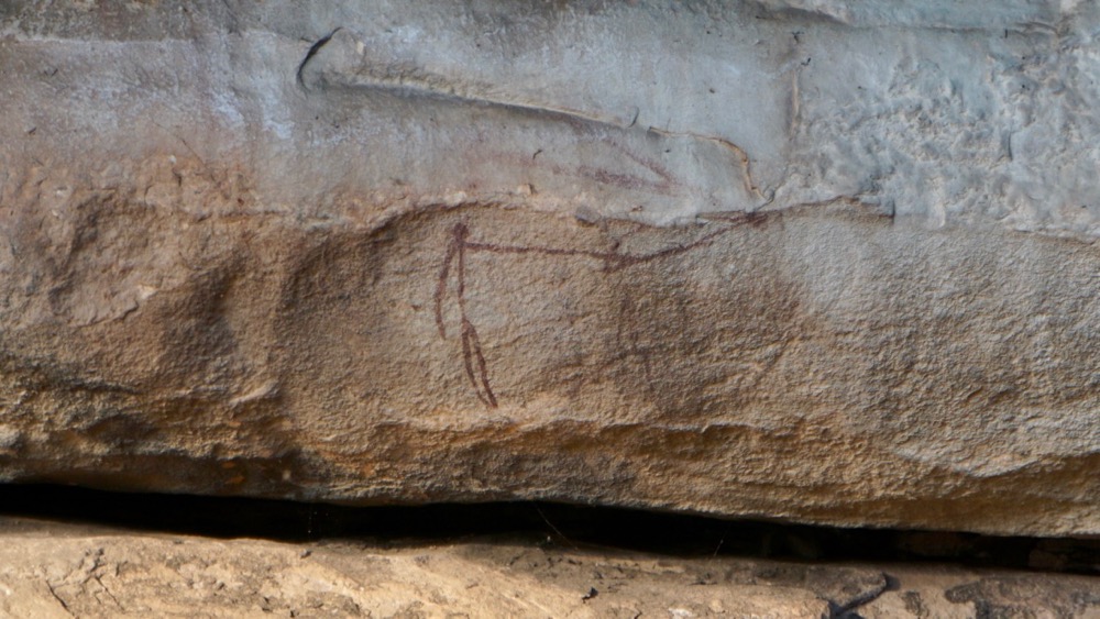
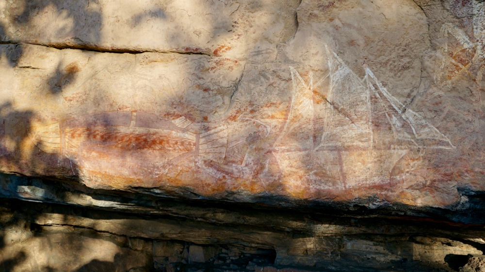
another drawing that is clearly much older is that of a man with a boomerang, which can be dated to more than 2000 years ago. the reason is that at this point sea leaves had risen steadily (the sea was moving inland by about 1 meter per week) and the change in climate had resulted in much denser woodlands where boomerangs didn’t work so well (they don’t return when they keep hitting trees).
maybe that’s what members of the current government have in mind when they continue to tout energy made from coal as a necessity: a much smaller yet maybe more fertile australia? i could imagine that after recent events some of them are probably even toying with the idea that tony abbott’s electorate of warringah will be swallowed up by the rising sea. one can only hope ….
as the land became less dry, first through the arrival of estuarine water, then through the monsoon rains resulting in abundant fresh water sources the fauna changed as well. turtles, file snakes, barramundi, water birds all arrived in numbers.
this ‘menu’ has been eternalised by a people who could afford to hunt less and focus on cultural activities. this rockart is amazingly detailed, almost a combined x-ray and grey’s anatomy painted on the classroom walls.
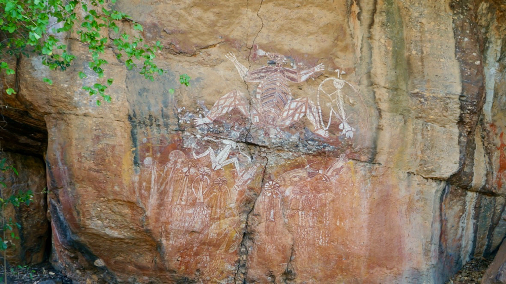
kakadu is not only home to some of the most amazing wildlife, it’s also an enormous art gallery, and one of the best we’ve seen. rangers have recorded 5000 art sites throughout the park and arnhem land, but they believe there are more than double that number still hidden.
as kakadu moves from wurrgeng (cold weather) to gurrung (hot dry weather) which means temperatures are rising towards 40 degrees during the day we started to evaluate our options and consider expediting our trip to the east coast. however, there are still a few more things to see here, even in this weather.
it was difficult to fly around kakau; we like to respect other people and their right to enjoy the sights. still, here are a few minutes of video that might give you an idea what the landscape looks like up there.
little video shot with old zippy.